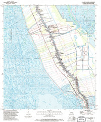
1994 Map of Golden Meadow
USGS Topo · Published 1995About this map
Bayou Lafourche serves as the central artery for this coastal landscape, where dense linear settlements like Galliano and Golden Meadow cling to the high ground along its banks. The map documents an intricate pattern of land use, from the narrow ribbon farms extending away from the bayou to the expansive marshlands of the Pointe Au Chien State Wildlife Management Area and the Catfish Lake basin. For genealogists, the sheet is particularly valuable for its density of family-named landmarks and cemeteries, including the St Joseph Ch Cem, Cheramie Cem, and Williams Cem. Infrastructure for the region's energy economy is also evident in the Bully Camp Field and the Clovelly Oil and Gas Field, while the presence of a Road Under Construction west of the bayou highlights the ongoing physical evolution of the parish in the mid-1990s.
Find a feature on this map
36 named features on this map. Tap any name to fly to it.
Don’t see what you’re looking for? This feature index may not catch every label — zoom into the map to look around manually.
Map Details
Editions of this 1994 Golden Meadow Map
This is the sole edition of this map. No revisions or reprints were ever made.
Other maps of this area

1892 · Barataria
USGS Topo · 1:62,500

1892 · Cut-Off
USGS Topo · 1:62,500

1892 · Creole
USGS Topo · 1:62,500

1894 · Lake Felicity
USGS Topo · 1:62,500

1935 · Viguerie Canal
USGS Topo · 1:31,680

1935 · Bay Courant
USGS Topo · 1:31,680

1935 · Golden Meadow
USGS Topo · 1:31,680

1935 · Mink Bayou
USGS Topo · 1:31,680

1939 · Cut-Off
USGS Topo · 1:62,500

1939 · Lake Felicity
USGS Topo · 1:62,500