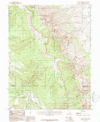
1987 Map of Golden Throne
USGS Topo · Published 1987About this map
Capitol Reef National Park and the rugged uplift of Miners Mountain dominate this late-1980s provisional survey of the South-Central Utah desert. The landscape is defined by the dramatic sandstone formations and drainage systems that have carved deep canyons through the reef, including Waterpocket Canyon and the winding Capitol Wash. Landmark monoliths like Golden Throne, Ferns Nipple, and the Eph Hanks Tower rise above the complex network of draws and flats, providing navigational anchors in a terrain otherwise devoid of significant permanent settlement.
Find a feature on this map
21 named features on this map. Tap any name to fly to it.
Don’t see what you’re looking for? This feature index may not catch every label — zoom into the map to look around manually.
Map Details
Editions of this 1987 Golden Throne Map
This is the sole edition of this map. No revisions or reprints were ever made.
Other maps of this area

1885 · Fish Lake
USGS Topo · 1:250,000

1896 · Fish Lake
USGS Topo · 1:250,000

1952 · Notom 4 SE
USGS Topo · 1:24,000

1952 · Notom 2 SE
USGS Topo · 1:24,000

1952 · Notom 4 NW
USGS Topo · 1:24,000

1952 · Notom 4 SW
USGS Topo · 1:24,000

1952 · Notom 4 NE
USGS Topo · 1:24,000

1952 · Notom 3 SE
USGS Topo · 1:24,000

1952 · Notom 3 NE
USGS Topo · 1:24,000

1952 · Notom 1 SW
USGS Topo · 1:24,000