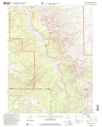
2002 Map of Golden Throne
USGS Topo · Published 2005About this map
Golden Throne rises as a dominant landmark within the geological complexities of the Waterpocket Fold on this 2002 revision. The landscape is defined by its deep drainages, including Capitol Wash and Pleasant Creek, which cut through the uplifted rock layers. Historical human presence is marked by archaeological and cultural sites such as Petroglyphs and the Pioneer Register, signaling the corridor's long-standing use as a travel route through the desert.
Find a feature on this map
27 named features on this map. Tap any name to fly to it.
Don’t see what you’re looking for? This feature index may not catch every label — zoom into the map to look around manually.
Map Details
Editions of this 2002 Golden Throne Map
This is the sole edition of this map. No revisions or reprints were ever made.
Other maps of this area

1885 · Fish Lake
USGS Topo · 1:250,000

1896 · Fish Lake
USGS Topo · 1:250,000

1952 · Notom 4 SE
USGS Topo · 1:24,000

1952 · Notom 2 SE
USGS Topo · 1:24,000

1952 · Notom 4 NW
USGS Topo · 1:24,000

1952 · Notom 4 SW
USGS Topo · 1:24,000

1952 · Notom 4 NE
USGS Topo · 1:24,000

1952 · Notom 3 SE
USGS Topo · 1:24,000

1952 · Notom 3 NE
USGS Topo · 1:24,000

1952 · Notom 1 SW
USGS Topo · 1:24,000