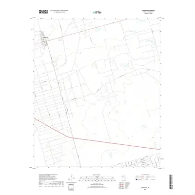
2019 Map of Goldsmith
USGS Topo · Published 2019About this map
Goldsmith occupies the upper left corner of this West Texas landscape, showing a grid of residential and industrial streets such as Gulf Ave and Midland St. This 2019 survey documents the expansive ranching and oil-lease country of Ector County, where the terrain is marked by a network of private and county roads including Y T Ranch RD and Altura Lease RD. The arid surroundings are dotted with numerous small lakes and depressions, a common geographic feature of the Permian Basin region. Many of these water bodies bear descriptive names such as Prairie Dog Lake, Mowing Machine Lake, and Antelope Lake, hinting at the wildlife and ranching equipment that define local landmarks. The dense grid of unnamed surface features and lease roads reflecting the region's energy production heritage contrasts with the open expanses surrounding Northwest Lake and James Lake.
Find a feature on this map
45 named features on this map. Tap any name to fly to it.
Don’t see what you’re looking for? This feature index may not catch every label — zoom into the map to look around manually.
Map Details
Editions of this 2019 Goldsmith Map
This is the sole edition of this map. No revisions or reprints were ever made.
Other maps of this area

1954 · Hobbs
USGS Topo · 1:250,000

1954 · Pecos
USGS Topo · 1:250,000

1957 · Pecos
USGS Topo · 1:250,000

1958 · Hobbs
USGS Topo · 1:250,000

1964 · Odessa SW
USGS Topo · 1:24,000

1964 · Odessa NW
USGS Topo · 1:24,000

1964 · Turnbaugh Corner
USGS Topo · 1:24,000

1964 · Douro
USGS Topo · 1:24,000

1964 · Red Lakes
USGS Topo · 1:24,000

1965 · Goldsmith
USGS Topo · 1:24,000