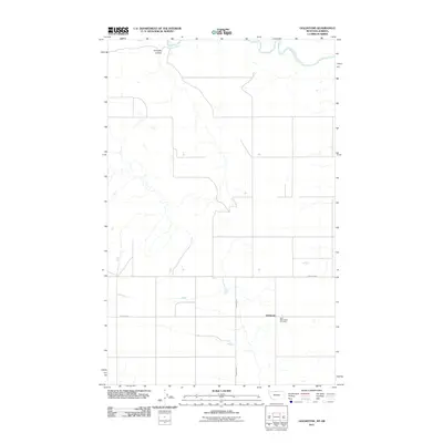
2011 Map of Goldstone
USGS Topo · Published 2011About this map
Goldstone occupies a central position in this prairie landscape along the northern border of Hill County, Montana. The settlement is defined by a strictly organized grid of sections and roads, including Rudyard Rd and County Hwy, which intersect near the community center. Just to the east of the townsite lies the Saint Wenceslaus Cemetery, a significant landmark for those tracing local family histories in this agricultural region. To the north, the terrain shifts near the Canadian border where the Milk River meanders across the international boundary, accompanied by the distinct landform of Kennedy Coulee. This map captures the area in the early 21st century, illustrating the enduring spatial layout of rural homesteading and the essential water routes that shaped early Montana settlement patterns.
Find a feature on this map
6 named features on this map. Tap any name to fly to it.
Don’t see what you’re looking for? This feature index may not catch every label — zoom into the map to look around manually.
Map Details
Editions of this 2011 Goldstone Map
This is the sole edition of this map. No revisions or reprints were ever made.
Other maps of this area

1919 · Alma
USGS Topo · 1:125,000

1920 · Gildford
USGS Topo · 1:125,000

1943 · Gildford
USGS Topo · 1:125,000

1954 · Shelby
USGS Topo · 1:250,000

1958 · Shelby
USGS Topo · 1:250,000

1972 · Goldstone SW
USGS Topo · 1:24,000

1972 · Mc Kinnsey Reservoir East
USGS Topo · 1:24,000

1972 · Mc Kinnsey Reservoir West
USGS Topo · 1:24,000
1972 · Lost River
USGS Topo · 1:24,000
1972 · Goldstone
USGS Topo · 1:24,000