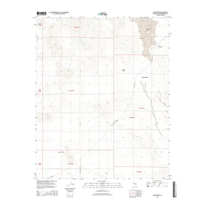
2015 Map of Goldstone
USGS Topo · Published 2015About this map
Goldstone and the nearby Mojave Base define this high-desert landscape in San Bernardino County, where specialized installations are situated within the vast Mojave Desert. The map reveals the infrastructure of the area, including the Goldstone /GTS/ Airport and the seasonal basin of Goldstone Lake to the north. These features sit at the edge of Superior Valley, where long stretches of Goldstone Rd and Paradise Springs Rd provide the primary access through the arid terrain. The presence of these facilities and technical infrastructure suggests the strategic and scientific importance of this remote section of the California desert during the mid-2010s.
Find a feature on this map
17 named features on this map. Tap any name to fly to it.
Don’t see what you’re looking for? This feature index may not catch every label — zoom into the map to look around manually.
Map Details
Editions of this 2015 Goldstone Map
This is the sole edition of this map. No revisions or reprints were ever made.
Other maps of this area

1915 · Searles Lake
USGS Topo · 1:250,000

1933 · Avawatz Mountains
USGS Topo · 1:250,000

1947 · Trona
USGS Topo · 1:250,000

1948 · Trona
USGS Topo · 1:250,000

1948 · Lane Mountain
USGS Topo · 1:62,500

1948 · Goldstone Lake
USGS Topo · 1:62,500

1951 · Goldstone Lake
USGS Topo · 1:62,500

1951 · Lane Mountain
USGS Topo · 1:62,500

1953 · Trona
USGS Topo · 1:250,000

1954 · Pilot Knob
USGS Topo · 1:62,500