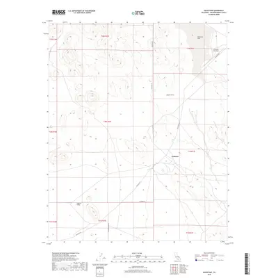
2018 Map of Goldstone
USGS Topo · Published 2018About this map
The Goldstone settlement and its nearby technical infrastructure are documented in this late 2010s survey of the northern Mojave Desert. This arid landscape is dominated by the dry expanse of Goldstone Lake in the northeastern corner, a feature that provides a natural landing area near the Goldstone /GTS Airport. The terrain transitions from the high-elevation flats of Superior Valley in the southwest toward the more mountainous reaches of the Mojave. Transportation through this isolated region is anchored by Randsburg Rd and Goldstone Rd, which intersect at the Goldstone site. These corridors, along with Paradise Springs Rd, delineate a high-desert environment where remote scientific and aviation operations rely on the stark, flat geography of the surrounding basins.
Find a feature on this map
17 named features on this map. Tap any name to fly to it.
Don’t see what you’re looking for? This feature index may not catch every label — zoom into the map to look around manually.
Map Details
Editions of this 2018 Goldstone Map
This is the sole edition of this map. No revisions or reprints were ever made.
Other maps of this area

1915 · Searles Lake
USGS Topo · 1:250,000

1933 · Avawatz Mountains
USGS Topo · 1:250,000

1947 · Trona
USGS Topo · 1:250,000

1948 · Trona
USGS Topo · 1:250,000

1948 · Lane Mountain
USGS Topo · 1:62,500

1948 · Goldstone Lake
USGS Topo · 1:62,500

1951 · Goldstone Lake
USGS Topo · 1:62,500

1951 · Lane Mountain
USGS Topo · 1:62,500

1953 · Trona
USGS Topo · 1:250,000

1954 · Pilot Knob
USGS Topo · 1:62,500