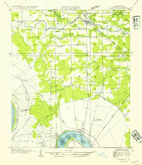
1954 Map of Gonzales
USGS Topo · Published 1954About this map
The Mississippi River creates a deep meander at Point Houmas on this mid-century survey of Ascension Parish. The landscape is a complex intersection of natural bayous and industrial infrastructure, where the Illinois Central Railroad and Arkansas and Louisiana Missouri Railway serve the riverfront economy. Evidence of the region's agricultural and industrial transition is visible in the proximity of Conway Plantation to the Belle Helene Refinery and Belle Helene Sta. Smaller communities such as Marchland and Burnside sit along the river's edge, while Gonzales develops at the junction of the Airline Highway. Rural life is marked by local landmarks like St Paul Church, Little Zion Ch, and the winding paths of Grand Bayou and New River.
Find a feature on this map
27 named features on this map. Tap any name to fly to it.
Don’t see what you’re looking for? This feature index may not catch every label — zoom into the map to look around manually.
Map Details
Editions of this 1954 Gonzales Map
This is the sole edition of this map. No revisions or reprints were ever made.
Other maps of this area

1892 · Donaldsonville
USGS Topo · 1:62,500

1908 · Baton Rouge
USGS Topo · 1:62,500

1934 · Denham Springs
USGS Topo · 1:62,500

1935 · Gonzales
USGS Topo · 1:31,680

1936 · White Castle
USGS Topo · 1:62,500

1939 · Denham Springs
USGS Topo · 1:62,500

1939 · Baton Rouge
USGS Topo · 1:62,500

1939 · Donaldsonville
USGS Topo · 1:62,500

1946 · Convent
USGS Topo · 1:31,680

1947 · Donaldsonville
USGS Topo · 1:31,680