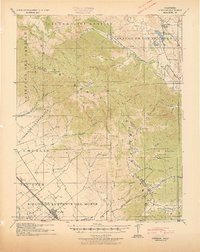
1941 Map of Gonzales
USGS Topo · Published 1941About this map
The Southern Pacific railroad corridor anchors the western valley of this Monterey County landscape, connecting the town of Gonzales with smaller agricultural stops like Dean and Zanjones. The terrain is defined by the sharp transition from the valley floor into the Gabilan Range, where Spanish land grant legacies are visible in the large tracts of Rincon De La Puente Del Monte and Encinal y Buena Esperanza. In the eastern hills, the San Benito River flows past the Paicines Ranch, a focal point for the settlement of Paicines.
Find a feature on this map
70 named features on this map. Tap any name to fly to it.
Don’t see what you’re looking for? This feature index may not catch every label — zoom into the map to look around manually.
Map Details
Editions of this 1941 Gonzales Map
This is the sole edition of this map. No revisions or reprints were ever made.
Other maps of this area

1910 · Gonzales
USGS Topo · 1:31,680

1910 · Salinas
USGS Topo · 1:31,680

1910 · Soledad
USGS Topo · 1:31,680

1912 · Salinas
USGS Topo · 1:62,500

1915 · Soledad
USGS Topo · 1:62,500

1915 · San Juan Bautista
USGS Topo · 1:48,000

1917 · San Juan Bautista
USGS Topo · 1:62,500

1919 · San Benito
USGS Topo · 1:62,500

1919 · Hollister
USGS Topo · 1:48,000

1920 · Jamesburg
USGS Topo · 1:48,000