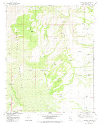
1980 Map of Gonzales Wash
USGS Topo · Published 1980About this map
The Aquarius Mountains dominate this Mohave County landscape, where water security dictated the patterns of settlement and ranching. The high country of the Lower Basin is marked by a network of vital water sources including Lower Basin Spring, Eds Tank, and Island Tank, which supported livestock across the high desert. Deep canyons such as Gonzales Canyon and Winslow Canyon cut through the terrain, while the Wagon Bow Ranch stands as a primary point of human habitation in the southern portion of the quadrangle.
Find a feature on this map
39 named features on this map. Tap any name to fly to it.
Don’t see what you’re looking for? This feature index may not catch every label — zoom into the map to look around manually.
Map Details
Editions of this 1980 Gonzales Wash Map
This is the sole edition of this map. No revisions or reprints were ever made.
Other maps of this area

1886 · Diamond Creek
USGS Topo · 1:250,000

1892 · Diamond Creek
USGS Topo · 1:250,000

1923 · Signal
USGS Topo · 1:250,000

1942 · Signal
USGS Topo · 1:250,000

1948 · Williams
USGS Topo · 1:250,000

1950 · Prescott
USGS Topo · 1:250,000

1954 · Prescott
USGS Topo · 1:250,000

1954 · Williams
USGS Topo · 1:250,000

1956 · Williams
USGS Topo · 1:250,000

1958 · Prescott
USGS Topo · 1:250,000