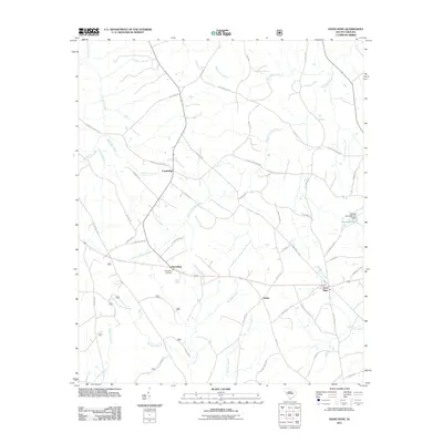
2011 Map of Good Hope
USGS Topo · Published 2011About this map
Good Hope and the surrounding rural landscape of Saluda County are defined by a complex network of tributaries and small settlements at the start of the 2010s. The area is anchored by the historical communities of Cambridge, Friendship, and Eulala, reflecting a long-standing South Carolina Piedmont agricultural pattern. Water is a dominant feature, with Halfway Swamp Creek and Ninety Six Creek draining much of the terrain. Genealogists will find interest in Friendship Cemetery, while industrial markers like the Adams Pond Dam D-1593 at Adams Pond indicate local water management. The map's road network, including the specifically named Tillman Territory Rd and Pidgeon Forge Rd, suggests the persistent paths of local travel connecting these hamlets. Notable water bodies such as Red Bank Creek and Mountain Creek further subdivide the land, creating a detailed record of the drainage basins as they stood in this era.
Find a feature on this map
58 named features on this map. Tap any name to fly to it.
Don’t see what you’re looking for? This feature index may not catch every label — zoom into the map to look around manually.
Map Details
Editions of this 2011 Good Hope Map
This is the sole edition of this map. No revisions or reprints were ever made.
Other maps of this area

1892 · Mc Cormick
USGS Topo · 1:125,000

1892 · Abbeville
USGS Topo · 1:125,000

1908 · Kirksey
USGS Topo · 1:24,000

1912 · Mc Cormick
USGS Topo · 1:125,000

1941 · Spartanburg
USGS Topo · 1:250,000

1949 · Ninety-Six
USGS Topo · 1:24,000

1950 · Kirksey
USGS Topo · 1:24,000

1953 · Athens
USGS Topo · 1:250,000

1953 · Spartanburg
USGS Topo · 1:250,000

1954 · Augusta
USGS Topo · 1:250,000