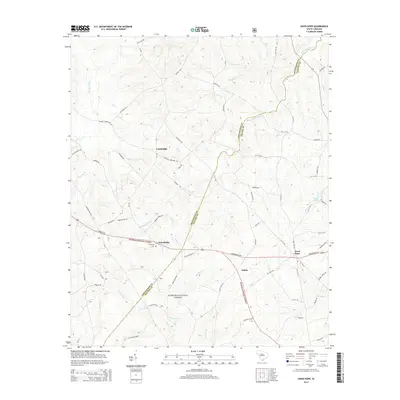
2014 Map of Good Hope
USGS Topo · Published 2014About this map
Friendship and the neighboring Friendship Cem occupy the center of this landscape, situated along the northern reaches of the Sumter National Forest. The geography is defined by a dense network of tributaries including Ninety Six Cr, Sixmile Cr, and Halfway Swamp Cr, which carve through the terrain between small settlements like Cambridge and Eulala. The transition between Greenwood and Saluda counties is marked by a winding boundary line that follows the path of these local waterways. To the east, the community of Good Hope serves as a local crossroads near the impounded waters of Adams Pond. The road network, including the Greenwood Hwy and numerous secondary routes like Tillman Territory Rd, illustrates a rural development pattern where small family settlements and timber lands are interconnected by long-established transit corridors.
Find a feature on this map
71 named features on this map. Tap any name to fly to it.
Don’t see what you’re looking for? This feature index may not catch every label — zoom into the map to look around manually.
Map Details
Editions of this 2014 Good Hope Map
This is the sole edition of this map. No revisions or reprints were ever made.
Other maps of this area

1892 · Mc Cormick
USGS Topo · 1:125,000

1892 · Abbeville
USGS Topo · 1:125,000

1908 · Kirksey
USGS Topo · 1:24,000

1912 · Mc Cormick
USGS Topo · 1:125,000

1941 · Spartanburg
USGS Topo · 1:250,000

1949 · Ninety-Six
USGS Topo · 1:24,000

1950 · Kirksey
USGS Topo · 1:24,000

1953 · Athens
USGS Topo · 1:250,000

1953 · Spartanburg
USGS Topo · 1:250,000

1954 · Augusta
USGS Topo · 1:250,000