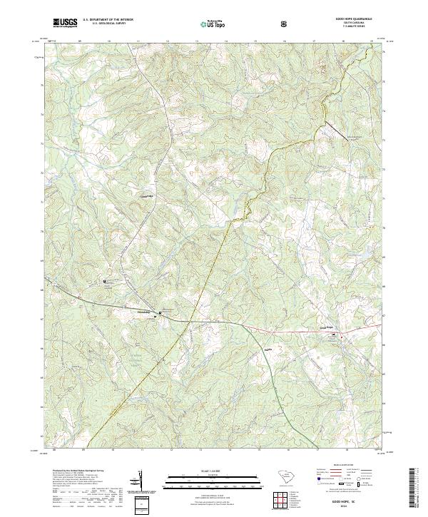
2024 Map of Good Hope
USGS Topo · Published 2024About this map
Cambridge and Good Hope serve as the primary nodes of settlement in this part of the South Carolina backcountry, where the boundary between Greenwood Co and Saluda Co follows the local topography. This landscape is defined by its deep spiritual and community roots, evidenced by several historic congregations and burial grounds. Genealogists can trace family names through sites like Good Hope Graveyard, the Antioch Baptist Church Cem, and the Mount Olive Graveyard near Friendship. The terrain is deeply dissected by a network of waterways including Mountain Creek, Sleepy Creek, and Halfway Swamp Creek, which feed into the broader regional drainage system. The southwestern portion of the sheet is largely occupied by the protected lands of the Sumter National Forest, illustrating a transition from active farmland and residential clusters toward managed timber and wilderness conservation.
Find a feature on this map
80 named features on this map. Tap any name to fly to it.
Don’t see what you’re looking for? This feature index may not catch every label — zoom into the map to look around manually.
Map Details
Editions of this 2024 Good Hope Map
This is the sole edition of this map. No revisions or reprints were ever made.
Other maps of this area

1892 · Mc Cormick
USGS Topo · 1:125,000

1892 · Abbeville
USGS Topo · 1:125,000

1908 · Kirksey
USGS Topo · 1:24,000

1912 · Mc Cormick
USGS Topo · 1:125,000

1941 · Spartanburg
USGS Topo · 1:250,000

1949 · Ninety-Six
USGS Topo · 1:24,000

1950 · Kirksey
USGS Topo · 1:24,000

1953 · Athens
USGS Topo · 1:250,000

1953 · Spartanburg
USGS Topo · 1:250,000

1954 · Augusta
USGS Topo · 1:250,000