
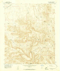
1972 Map of Good Sight Peak NE
USGS Topo · Published 1975About this map
The historical Butterfield Trail cuts through this high desert landscape, tracing a route across the Uvas Valley during the early 1970s. The terrain is defined by the sharp transition from the level valley floor to the prominent ridges of the Sierra De Las Uvas, which dominate the eastern half of the map. Ranching infrastructure is scattered throughout this arid environment, marked by the Pole M Ranch, Wright Windmill, and Howard Tank. To the south, Massacre Peak stands as a significant landmark along the Jeep Trail, highlighting the remote and often difficult nature of the regional travel routes. This survey also captures the political boundary between Luna Co and Doña Ana Co as it meanders through the mountainous terrain.
Find a feature on this map
13 named features on this map. Tap any name to fly to it.
Don’t see what you’re looking for? This feature index may not catch every label — zoom into the map to look around manually.
Map Details
Editions of this 1972 Good Sight Peak NE Map
This is the sole edition of this map. No revisions or reprints were ever made.
Other maps of this area

1943 · Corralitos Ranch
USGS Topo · 1:62,500

1955 · Las Cruces
USGS Topo · 1:250,000

1958 · Las Cruces
USGS Topo · 1:250,000
1959 · Souse Springs
USGS Topo · 1:24,000

1961 · Nutt
USGS Topo · 1:62,500

1972 · Myndus
USGS Topo · 1:24,000

1972 · Good Sight Peak
USGS Topo · 1:24,000

1972 · Lazy E Ranch
USGS Topo · 1:24,000

1982 · Hatch
USGS Topo · 1:100,000
1982 · Deming
USGS Topo · 1:100,000