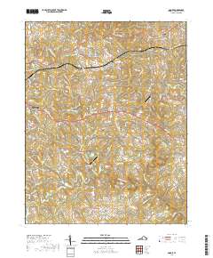
2019 Map of Goode
USGS Topo · Published 2019About this map
The convergence of the Big Otter River and Little Otter River defines the drainage patterns of this Bedford County landscape, where rural communities like Lowry and Goode are connected by the historic corridor of the Lynchburg-Salem Tpke. This 2019 survey documents the modern layout of Bedford, showing the intricate web of named lanes such as Bell Town Rd and Dowdy-Rock Rd that serve the surrounding farms and homesteads. Local landmarks like Miller Airport and Hawk Ridge Airport reflect the area's ongoing use of small-scale aviation infrastructure.
Find a feature on this map
129 named features on this map. Tap any name to fly to it.
Don’t see what you’re looking for? This feature index may not catch every label — zoom into the map to look around manually.
Map Details
Editions of this 2019 Goode Map
This is the sole edition of this map. No revisions or reprints were ever made.
Other maps of this area

1890 · Roanoke
USGS Topo · 1:125,000

1891 · Roanoke
USGS Topo · 1:125,000

1892 · Lynchburg
USGS Topo · 1:125,000

1947 · Roanoke
USGS Topo · 1:250,000

1950 · Goode
USGS Topo · 1:62,500

1950 · Peaks of Otter
USGS Topo · 1:62,500

1951 · Moneta
USGS Topo · 1:62,500

1951 · Altavista
USGS Topo · 1:62,500

1959 · Roanoke
USGS Topo · 1:250,000

1963 · Roanoke
USGS Topo · 1:250,000