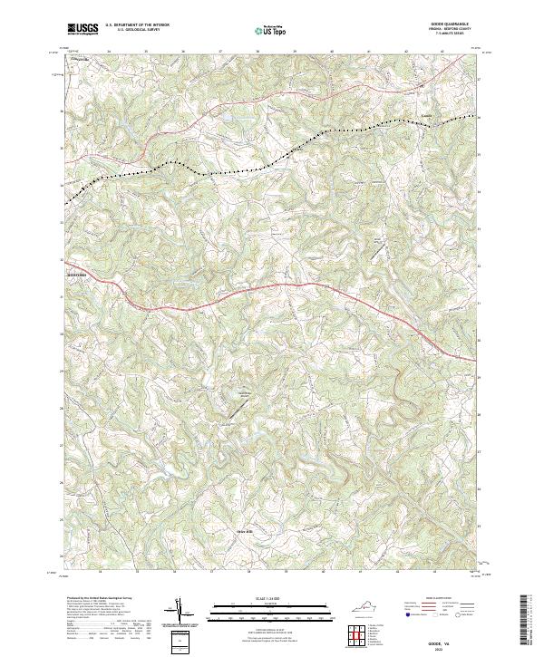
2022 Map of Goode
USGS Topo · Published 2022About this map
The Little Otter River and Big Otter River define the undulating landscape of Bedford County, where rural crossroads and modern aviation intersect. Small settlements such as Centerville, Lowry, and Goode are scattered throughout the region, many connected by the Norfolk Southern rail line and established routes like the E Lynchburg-Salem Tpke. Local geography is marked by distinctive names like Screechum Hollow and Hawkins Ridge, alongside smaller water bodies including Markham Pond and Machine Creek. Private aviation is notably represented by Miller Airport and Hawk Ridge Airport, highlighting the area's continued reliance on local airstrips. The map also captures the outer reaches of Bedford, showing the transition from the town center into the more dispersed community of Otter Hill to the south. This terrain is crisscrossed by a dense network of family-named roads, from Gandy Rd to Wingfield Dr, reflecting generations of residential development.
Find a feature on this map
127 named features on this map. Tap any name to fly to it.
Don’t see what you’re looking for? This feature index may not catch every label — zoom into the map to look around manually.
Map Details
Editions of this 2022 Goode Map
This is the sole edition of this map. No revisions or reprints were ever made.
Other maps of this area

1890 · Roanoke
USGS Topo · 1:125,000

1891 · Roanoke
USGS Topo · 1:125,000

1892 · Lynchburg
USGS Topo · 1:125,000

1947 · Roanoke
USGS Topo · 1:250,000

1950 · Goode
USGS Topo · 1:62,500

1950 · Peaks of Otter
USGS Topo · 1:62,500

1951 · Moneta
USGS Topo · 1:62,500

1951 · Altavista
USGS Topo · 1:62,500

1959 · Roanoke
USGS Topo · 1:250,000

1963 · Roanoke
USGS Topo · 1:250,000