
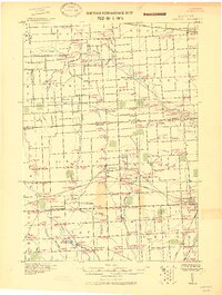
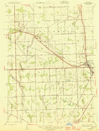
1939 Map of Goodells
USGS Topo · Published 1939About this map
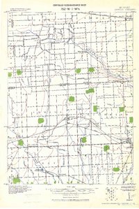
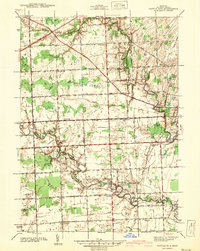
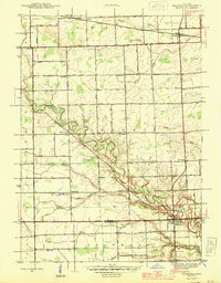
St. Clair County's rural landscape at the end of the 1930s is defined by a dense network of township schools and a sophisticated drainage system supporting its agricultural vitality. The Grand Trunk Western railroad serves as the primary corridor through the northern half of the map, passing through the settlement of Goodells and past the prominent St Clair County Infirmary. This survey details the transition from the wooded areas near the Belle River in the southwest to the organized farmlands of Wales and Kenockee townships.
Find a feature on this map
76 named features on this map. Tap any name to fly to it.
Don’t see what you’re looking for? This feature index may not catch every label — zoom into the map to look around manually.
Map Details
Editions of this 1939 Goodells Map
This is the sole edition of this map. No revisions or reprints were ever made.
Other maps of this area
1914 · Armada
USGS Topo · 1:62,500
1928 · Armada
USGS Topo · 1:62,500

1928 · Hicky
USGS Topo · 1:62,500

1936 · Rattle Run
USGS Topo · 1:31,680

1939 · Adair
USGS Topo · 1:24,000

1939 · Smiths Creek
USGS Topo · 1:24,000
1942 · Rattle Run
USGS Topo · 1:24,000
1944 · Memphis
USGS Topo · 1:24,000
1945 · Richmond
USGS Topo · 1:24,000
1952 · Memphis
USGS Topo · 1:24,000
Featured Places
- Columbus Township, MI
- Wales Center, Wales Township
- Clyde Township, MI
- Lambs, Wales Township
- Riley Township, MI