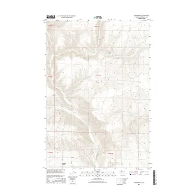
2017 Map of Goodnoe Hills
USGS Topo · Published 2017About this map
Goodnoe Hills and its surrounding high plateau are defined by a series of dramatic drainages and ridges in Klickitat County. The landscape is carved by seasonal waterways including Rock Creek, White Creek, and Squaw Creek, which flow through steep depressions like Glass Canyon. Settlement in this era is concentrated along the southern corridor, where the legacy of earlier transportation is visible in names like Old Hwy 8. The map documents a network of rural roads that follow the contours of the land and section lines, such as Chamberlain Goodnoe Rd and Hoctor Rd. High points such as Harrison Ridge overlook the complex system of coulees and canyons, illustrating the topographical transition from the high hills down toward the Columbia River basin. This survey provides a clear view of land divisions and property access routes in a remote portion of southern Washington.
Find a feature on this map
23 named features on this map. Tap any name to fly to it.
Don’t see what you’re looking for? This feature index may not catch every label — zoom into the map to look around manually.
Map Details
Editions of this 2017 Goodnoe Hills Map
This is the sole edition of this map. No revisions or reprints were ever made.
Other maps of this area

1916 · Arlington
USGS Topo · 1:125,000

1953 · The Dalles
USGS Topo · 1:250,000

1956 · The Dalles
USGS Topo · 1:250,000

1957 · The Dalles
USGS Topo · 1:250,000

1957 · Wasco
USGS Topo · 1:62,500

1957 · Satus Pass
USGS Topo · 1:62,500

1965 · Goodnoe Hills
USGS Topo · 1:24,000
1965 · Bickleton
USGS Topo · 1:24,000
1965 · Dot
USGS Topo · 1:24,000
1965 · Bickleton NW
USGS Topo · 1:24,000