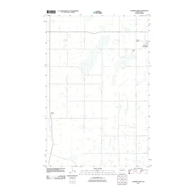
2011 Map of Goodrich West
USGS Topo · Published 2011About this map
Goodrich stands as the primary settlement on this Sheridan County landscape, where the prairie is defined by a dense network of small seasonal wetlands and depressions characteristic of the Missouri Coteau region. This 2011 survey illustrates the rural grid system and local infrastructure, notably the Goodrich Cemetery and Goodrich Adventist Cemetery located just north of the town center. Further west, the Denhoff Adventist Cemetery sits as a solitary landmark along the section line near Main St E. The map's detail is focused on the surveyed road system, including routes like 19th Ave NE and 17th Ave NE, which navigate the scattered water bodies and agricultural plots that dominate the terrain north of the town site.
Find a feature on this map
20 named features on this map. Tap any name to fly to it.
Don’t see what you’re looking for? This feature index may not catch every label — zoom into the map to look around manually.
Map Details
Editions of this 2011 Goodrich West Map
This is the sole edition of this map. No revisions or reprints were ever made.
Other maps of this area

1946 · Sheyenne Lake
USGS Topo · 1:48,000

1947 · Lincoln Valley
USGS Topo · 1:62,500

1947 · Sheyenne Lake
USGS Topo · 1:62,500

1954 · McClusky
USGS Topo · 1:250,000

1958 · McClusky
USGS Topo · 1:250,000

1960 · Lincoln Valley SE
USGS Topo · 1:24,000

1960 · Florence Lake
USGS Topo · 1:24,000

1960 · Denhoff
USGS Topo · 1:24,000
1978 · Mertz Slough
USGS Topo · 1:24,000
1978 · Pony Gulch
USGS Topo · 1:24,000