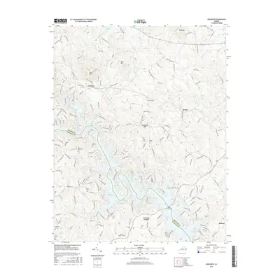
2016 Map of Goodview
USGS Topo · Published 2016About this map
Smith Mountain Lake dominates the southern landscape of this Virginia survey, where the borders of Bedford and Franklin counties meet among a complex network of coves and inlets. The terrain is defined by prominent ridges such as Board Mtn and Kasey Mtn, which overlook the growing community of Goodview and the smaller settlements of Meador and Diamond Hill. The map reveals a high density of family and community burial sites, including the Basham Cem, Ellis-Blankenship Cem, and the Booth-Joplin Cem, providing essential geographic markers for genealogical research in this part of the Piedmont. Extensive secondary roads like Goodview Rd and Old Plantation Rd navigate the undulating valley floor, connecting historic farmsteads with the modern lakeside developments at Westlake Corner.
Find a feature on this map
176 named features on this map. Tap any name to fly to it.
Don’t see what you’re looking for? This feature index may not catch every label — zoom into the map to look around manually.
Map Details
Editions of this 2016 Goodview Map
This is the sole edition of this map. No revisions or reprints were ever made.
Other maps of this area

1890 · Roanoke
USGS Topo · 1:125,000

1891 · Roanoke
USGS Topo · 1:125,000

1929 · Roanoke
USGS Topo · 1:48,000

1933 · Roanoke
USGS Topo · 1:62,500

1947 · Roanoke
USGS Topo · 1:250,000

1950 · Peaks of Otter
USGS Topo · 1:62,500

1951 · Boones Mill
USGS Topo · 1:62,500

1951 · Moneta
USGS Topo · 1:62,500

1959 · Roanoke
USGS Topo · 1:250,000

1963 · Roanoke
USGS Topo · 1:250,000