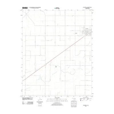
2010 Map of Goodwell
USGS Topo · Published 2010About this map
Goodwell serves as the primary hub for this portion of the Oklahoma Panhandle, showing a distinct grid of streets and academic corridors centered around its local institutions. The surrounding landscape in Texas County is defined by an extensive network of rural roads such as Co RD 20 and Mile 21, which organize the agricultural terrain. To the southwest of the town site, the Goodwell Cemetery sits along the section lines, providing a central point for genealogical research. The local topography is carved by the North Fork Frisco Creek, which meanders across the southern half of the quadrangle. This drainage system is modified by the Etling Number 2 Dam, an important water management feature for the region's ranching or farming economy. The presence of Co Hwy 51 slicing diagonally through the grid illustrates the modern transportation patterns that connect this rural community to the wider state network.
Find a feature on this map
34 named features on this map. Tap any name to fly to it.
Don’t see what you’re looking for? This feature index may not catch every label — zoom into the map to look around manually.
Map Details
Editions of this 2010 Goodwell Map
This is the sole edition of this map. No revisions or reprints were ever made.
Other maps of this area

1954 · Perryton
USGS Topo · 1:250,000

1958 · Perryton
USGS Topo · 1:250,000

1973 · Texhoma NE
USGS Topo · 1:24,000

1973 · Goodwell SE
USGS Topo · 1:24,000

1973 · Texhoma North
USGS Topo · 1:24,000

1973 · Goodwell NW
USGS Topo · 1:24,000

1973 · Goodwell
USGS Topo · 1:24,000

1973 · Goodwell NE
USGS Topo · 1:24,000

1974 · Sunray 1 NW
USGS Topo · 1:24,000

1974 · Texhoma South
USGS Topo · 1:24,000