
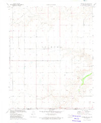
1974 Map of Texhoma South
USGS Topo · Published 1977About this map
Texhoma straddles the high plains border in the mid-1970s, defined by the long diagonal of the Chicago Rock Island and Pacific railroad and the sharp division of the Oklahoma Texas state line. This survey captures a landscape dominated by the energy economy of the Panhandle, punctuated by a dense network of Gas Wells, Oil Wells, and several Pipelines crossing the terrain. The transition from the flat, developed townsite—complete with its Golf Course and local Cem—to the more irregular breaks near Frisco Creek illustrates the stark topography of the region. While the northern portion is structured by a rigid grid of property boundaries and service roads, the southeast corner reveals deeper erosion patterns and local industrial activity at the Gravel Pits.
Find a feature on this map
12 named features on this map. Tap any name to fly to it.
Don’t see what you’re looking for? This feature index may not catch every label — zoom into the map to look around manually.
Map Details
Editions of this 1974 Texhoma South Map
This is the sole edition of this map. No revisions or reprints were ever made.
Other maps of this area

1954 · Perryton
USGS Topo · 1:250,000

1958 · Perryton
USGS Topo · 1:250,000

1964 · Stevens SW
USGS Topo · 1:24,000

1965 · Stevens
USGS Topo · 1:24,000

1973 · Texhoma North
USGS Topo · 1:24,000
1973 · Texhoma SW
USGS Topo · 1:24,000

1973 · Goodwell
USGS Topo · 1:24,000

1974 · Sunray 1 NW
USGS Topo · 1:24,000

1974 · Stevens SE
USGS Topo · 1:24,000

1974 · Sunray 1 SW
USGS Topo · 1:24,000