
1974 Map of Stevens SE
USGS Topo · Published 1977About this map
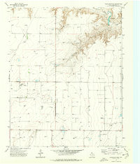
The High Plains landscape of the Texas Panhandle in the mid-1970s is defined by a dense network of energy infrastructure cutting across the open range. In this corner of Sherman County, the topography is carved by the winding drainage of Coldwater Creek in the south and Frisco Creek to the north, creating the only significant relief in an otherwise flat industrial expanse. The map reveals the intense development of the regional gas fields, with numerous Gas Wells and an extensive grid of Pipelines connecting to a central Pumping Sta. Local industry is further evidenced by scattered Gravel Pits and several Oil Wells. This survey captures the region at a peak of petroleum activity, documenting how the utilitarian needs of the oil and gas industry reshaped the rural landscape through a complex system of service roads, storage Tanks, and extraction points.
Find a feature on this map
10 named features on this map. Tap any name to fly to it.
Don’t see what you’re looking for? This feature index may not catch every label — zoom into the map to look around manually.
Map Details
Editions of this 1974 Stevens SE Map
This is the sole edition of this map. No revisions or reprints were ever made.
Other maps of this area

1954 · Perryton
USGS Topo · 1:250,000

1958 · Perryton
USGS Topo · 1:250,000

1964 · Stevens SW
USGS Topo · 1:24,000

1965 · Spurlock Chapel
USGS Topo · 1:24,000

1965 · Stevens
USGS Topo · 1:24,000

1974 · Sunray 1 NW
USGS Topo · 1:24,000

1974 · Texhoma South
USGS Topo · 1:24,000

1974 · Sunray 1 SW
USGS Topo · 1:24,000

1974 · Capps Switch NW
USGS Topo · 1:24,000
1974 · Pleasure Pond
USGS Topo · 1:24,000