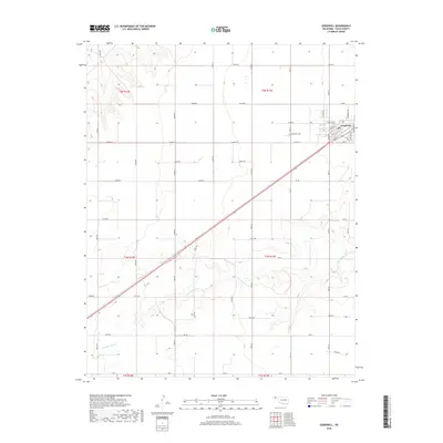
2018 Map of Goodwell
USGS Topo · Published 2018About this map
Goodwell serves as the focal point of this Panhandle landscape, where the town's grid is defined by streets like Church St, Main St, and Eagle Blvd. The influence of the local university is evident in thoroughfares such as Aggie Ave and Tyler Ave, which anchor the community’s northern edge. Outside the developed center, the terrain is characterized by a series of sections including t2n r13e and t1n r13e, where the elevation contours trace the winding path of N Fork Frisco Cr as it cuts through the plains. This 2018 survey reveals the persistent geometry of the high plains, with the Goodwell Cem situated west of town and a dense network of section line roads like Co Hwy 51 and Rd DD facilitating travel across the agricultural expanses of Texas County.
Find a feature on this map
54 named features on this map. Tap any name to fly to it.
Don’t see what you’re looking for? This feature index may not catch every label — zoom into the map to look around manually.
Map Details
Editions of this 2018 Goodwell Map
This is the sole edition of this map. No revisions or reprints were ever made.
Other maps of this area

1954 · Perryton
USGS Topo · 1:250,000

1958 · Perryton
USGS Topo · 1:250,000

1973 · Texhoma NE
USGS Topo · 1:24,000

1973 · Goodwell SE
USGS Topo · 1:24,000

1973 · Texhoma North
USGS Topo · 1:24,000

1973 · Goodwell NW
USGS Topo · 1:24,000

1973 · Goodwell
USGS Topo · 1:24,000

1973 · Goodwell NE
USGS Topo · 1:24,000

1974 · Sunray 1 NW
USGS Topo · 1:24,000

1974 · Texhoma South
USGS Topo · 1:24,000