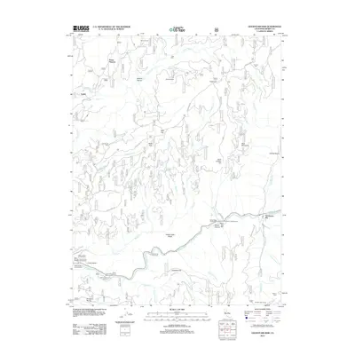
2012 Map of Goodyears Bar
USGS Topo · Published 2012About this map
Goodyears Bar and the steep river canyons of the northern Gold Country are meticulously documented in this 2012 study of Sierra County. The area’s long mining legacy remains visible through the names of various lode and placer works, including the Bunker Hill Mine near Cherokee Creek and the Magnolia Mine beneath the shadow of Sugarloaf. The rugged topography is defined by the North Yuba River, which flows past landmarks like Saint Joe Bar and several riverside recreation spots such as the Fiddle Creek Camp Ground. Higher elevations are marked by historical family sites and remote outposts, from Marvin Ranch in the north to the Old Mountain House in the southeast. This map provides a clear view of the complex logging and forest road network, including Eureka Mine Road and Brandy City Road, which connect these historically isolated ridge-top settlements and mineral claims.
Find a feature on this map
59 named features on this map. Tap any name to fly to it.
Don’t see what you’re looking for? This feature index may not catch every label — zoom into the map to look around manually.
Map Details
Editions of this 2012 Goodyears Bar Map
This is the sole edition of this map. No revisions or reprints were ever made.
Other maps of this area

1888 · Smartsville
USGS Topo · 1:125,000

1888 · Bidwell Bar
USGS Topo · 1:125,000

1891 · Bidwell Bar
USGS Topo · 1:125,000

1891 · Downieville
USGS Topo · 1:125,000

1891 · Colfax
USGS Topo · 1:125,000

1891 · Smartsville
USGS Topo · 1:125,000

1892 · Smartsville
USGS Topo · 1:125,000

1892 · Colfax
USGS Topo · 1:125,000

1893 · Bidwell Bar
USGS Topo · 1:125,000

1893 · Downieville
USGS Topo · 1:125,000