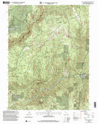
2000 Map of Goodyears Bar
USGS Topo · Published 2003About this map
Goodyears Bar and the surrounding Sierra Nevada terrain are defined by a complex history of hydraulic and hard-rock mining at the turn of the millennium. This territory, split between the Plumas National Forest and Tahoe National Forest, shows the deep scars and lasting infrastructure of the California Gold Rush. The landscape is punctuated by massive workings like the Eureka Diggings and the distinct tailings near Indian Valley.
Find a feature on this map
39 named features on this map. Tap any name to fly to it.
Don’t see what you’re looking for? This feature index may not catch every label — zoom into the map to look around manually.
Map Details
Editions of this 2000 Goodyears Bar Map
This is the sole edition of this map. No revisions or reprints were ever made.
Other maps of this area

1888 · Smartsville
USGS Topo · 1:125,000

1888 · Bidwell Bar
USGS Topo · 1:125,000

1891 · Bidwell Bar
USGS Topo · 1:125,000

1891 · Downieville
USGS Topo · 1:125,000

1891 · Colfax
USGS Topo · 1:125,000

1891 · Smartsville
USGS Topo · 1:125,000

1892 · Smartsville
USGS Topo · 1:125,000

1892 · Colfax
USGS Topo · 1:125,000

1893 · Bidwell Bar
USGS Topo · 1:125,000

1893 · Downieville
USGS Topo · 1:125,000