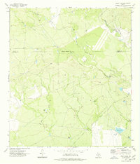
1974 Map of Goofy Lake
USGS Topo · Published 1977About this map
Holingreen Ranch and a remote Landing Strip characterize the cattle-ranching landscape of this South Texas borderland region during the mid-1970s. The terrain is defined by a complex network of intermittent watercourses, including Muela Creek, Chaparrosa Creek, and Palo Blanco Creek, which drain into the low-lying areas near the namesake Goofy Lake. Because of the arid climate, the map reveals a high density of man-made water features essential for livestock, such as Lewis Tank, Roosevelt Tank, and Boggy Tank. The landscape is further divided by the Kinney Co Maverick Co line, which follows an Indefinite Boundary through the West Prong and East Prong drainages. This survey provides a rare look at the isolated ranching infrastructure and topography of the Brush Country before modern developments changed the local land use.
Find a feature on this map
21 named features on this map. Tap any name to fly to it.
Don’t see what you’re looking for? This feature index may not catch every label — zoom into the map to look around manually.
Map Details
Editions of this 1974 Goofy Lake Map
This is the sole edition of this map. No revisions or reprints were ever made.
Other maps of this area

1896 · Brackett
USGS Topo · 1:125,000

1897 · Brackett
USGS Topo · 1:125,000

1940 · Paloma
USGS Topo · 1:62,500

1940 · Chacon Creek
USGS Topo · 1:62,500

1944 · Spofford
USGS Topo · 1:62,500

1949 · Cline
USGS Topo · 1:62,500

1958 · Eagle Pass
USGS Topo · 1:250,000

1958 · Del Rio
USGS Topo · 1:250,000

1964 · Del Rio
USGS Topo · 1:250,000

1965 · Eagle Pass
USGS Topo · 1:250,000