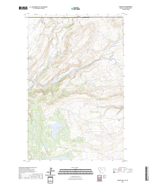
2024 Map of Goose Lake
USGS Topo · Published 2024About this map
The Canada United States of America international border forms the northern limit of this high-latitude terrain, where the hydrography of the Continental Divide begins its complex descent. The Saint Mary River flows northward through the western section, while the Saint Mary Canal represents a significant feat of early 20th-century water management, engineered to divert water from the Saint Mary basin into the North Fork Milk River.
Find a feature on this map
17 named features on this map. Tap any name to fly to it.
Don’t see what you’re looking for? This feature index may not catch every label — zoom into the map to look around manually.
Map Details
Editions of this 2024 Goose Lake Map
This is the sole edition of this map. No revisions or reprints were ever made.
Other maps of this area

1901 · Browning
USGS Topo · 1:125,000

1903 · Browning
USGS Topo · 1:125,000

1960 · Cut Bank
USGS Topo · 1:250,000

1963 · Cut Bank
USGS Topo · 1:250,000

1964 · Cut Bank
USGS Topo · 1:250,000

1968 · Babb
USGS Topo · 1:24,000
1968 · Duck Lake
USGS Topo · 1:24,000
1968 · Pike Lake
USGS Topo · 1:24,000
1968 · Hall Coulee
USGS Topo · 1:24,000
1968 · Wetzel
USGS Topo · 1:24,000