
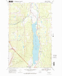
1968 Map of Babb
USGS Topo · Published 1971About this map
Babb serves as a vital gateway on the edge of the Blackfeet Indian Reservation Boundary and Glacier National Park during this late 1960s survey. The settlement is centered around local services like the Babb Sch and the Babb Airport, while the landscape is defined by the massive expanse of Lower Saint Mary Lake. This aquatic corridor is flanked by significant recreational and infrastructure points, including the Malmstrom Air Force Base Recreation Area and the Saint Mary Canal, which reflects the complex water management and land-use history of the region.
Find a feature on this map
30 named features on this map. Tap any name to fly to it.
Don’t see what you’re looking for? This feature index may not catch every label — zoom into the map to look around manually.
Map Details
Editions of this 1968 Babb Map
2 editions found
Other maps of this area

1901 · Browning
USGS Topo · 1:125,000

1903 · Browning
USGS Topo · 1:125,000

1904 · Chief Mountain
USGS Topo · 1:125,000

1938 · Chief Mountain
USGS Topo · 1:125,000

1960 · Cut Bank
USGS Topo · 1:250,000

1963 · Cut Bank
USGS Topo · 1:250,000

1964 · Cut Bank
USGS Topo · 1:250,000

1968 · Saint Mary
USGS Topo · 1:24,000

1968 · Josephine
USGS Topo · 1:24,000
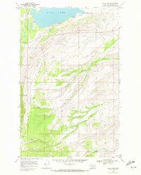
1968 · Duck Lake
USGS Topo · 1:24,000