
1968 Map of Saint Mary
USGS Topo · Published 1971About this map
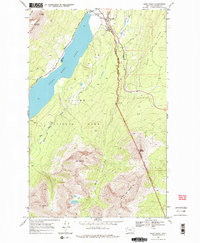
Saint Mary Lake serves as the focal point for this survey, which documents the eastern threshold of Glacier National Park during the late 1960s. The settlement of Saint Mary acts as a gateway near the Entrance Sta and Visitor Center, where the famed Going-To-The-Sun Road begins its ascent westward. The map reveals a landscape defined by the intersection of federal parkland and the Blackfeet Indian Reservation Boundary, which runs along the high crests of Saint Mary Ridge. To the south and west, the terrain rises into formidable peaks like Divide Mountain and Curly Bear Mountain. This detailed study illustrates the established trail systems of the era, including the Red Eagle Trail, and traces the complex hydrology of the eastern front where Two Dog Creek and Red Eagle Creek feed into the lake.
Find a feature on this map
22 named features on this map. Tap any name to fly to it.
Don’t see what you’re looking for? This feature index may not catch every label — zoom into the map to look around manually.
Map Details
Editions of this 1968 Saint Mary Map
3 editions found
Other maps of this area

1901 · Browning
USGS Topo · 1:125,000

1903 · Browning
USGS Topo · 1:125,000

1904 · Chief Mountain
USGS Topo · 1:125,000

1938 · Chief Mountain
USGS Topo · 1:125,000

1960 · Cut Bank
USGS Topo · 1:250,000

1963 · Cut Bank
USGS Topo · 1:250,000

1964 · Cut Bank
USGS Topo · 1:250,000

1968 · Babb
USGS Topo · 1:24,000

1968 · Josephine
USGS Topo · 1:24,000
1968 · Cut Bank Pass
USGS Topo · 1:24,000