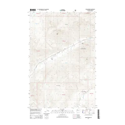
2014 Map of Goose Prairie
USGS Topo · Published 2014About this map
The American River and Bumping River carve through high elevation terrain within the Snoqualmie National Forest on this 2014 survey. Small settlements like Goose Prairie and Pleasant Valley occupy the narrow valley floor, positioned along State Hwy 410, which follows the river's path through the mountains. The landscape is defined by dramatic vertical relief, with Fifes Peaks and Goat Peak standing over complex drainages like Union Cr and Kettle Cr.
Find a feature on this map
37 named features on this map. Tap any name to fly to it.
Don’t see what you’re looking for? This feature index may not catch every label — zoom into the map to look around manually.
Map Details
Editions of this 2014 Goose Prairie Map
This is the sole edition of this map. No revisions or reprints were ever made.
Other maps of this area

1901 · Snoqualmie Pass
USGS Topo · 1:125,000

1902 · Mount Aix
USGS Topo · 1:125,000

1903 · Snoqualmie
USGS Topo · 1:125,000

1904 · Mt Aix
USGS Topo · 1:125,000

1950 · Yakima
USGS Topo · 1:250,000

1957 · Wenatchee
USGS Topo · 1:250,000

1958 · Yakima
USGS Topo · 1:250,000

1961 · Yakima
USGS Topo · 1:250,000

1961 · Easton
USGS Topo · 1:62,500

1962 · Bumping Lake
USGS Topo · 1:62,500