
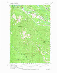
1961 Map of Easton
USGS Topo · Published 1963About this map
The upper Yakima River valley serves as the central corridor for this early 1960s survey, defined by the heavy presence of the Northern Pacific and Chicago Milwaukee St Paul and Pacific railroads. The mining legacy of the Upper Kittitas is centered around Roslyn, Ronald, and the Roslyn-Cascade Mine 4, illustrating the region's industrial backbone just south of Cle Elum Lake.
Find a feature on this map
70 named features on this map. Tap any name to fly to it.
Don’t see what you’re looking for? This feature index may not catch every label — zoom into the map to look around manually.
Map Details
Editions of this 1961 Easton Map
2 editions found
Other maps of this area

1897 · Mount Stuart
USGS Topo · 1:125,000

1899 · Ellensburg
USGS Topo · 1:125,000

1901 · Ellensburg
USGS Topo · 1:125,000

1901 · Snoqualmie Pass
USGS Topo · 1:125,000

1902 · Mount Aix
USGS Topo · 1:125,000

1902 · Mount Stuart
USGS Topo · 1:125,000

1903 · Snoqualmie
USGS Topo · 1:125,000

1904 · Mt Aix
USGS Topo · 1:125,000

1950 · Yakima
USGS Topo · 1:250,000

1957 · Wenatchee
USGS Topo · 1:250,000