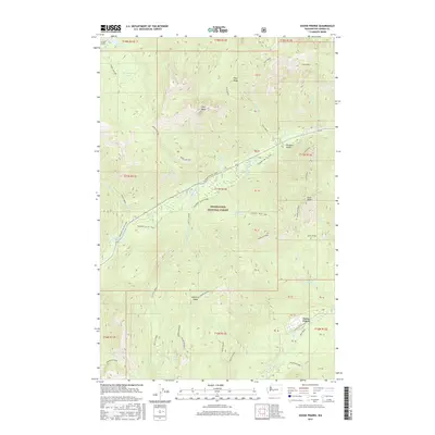
2017 Map of Goose Prairie
USGS Topo · Published 2017About this map
Goose Prairie sits at the convergence of the Bumping River and its tributary creeks in this 2017 study of the Snoqualmie National Forest. The landscape is dominated by high-elevation landforms, including the sharp points of Fifes Peaks and the long expanse of American Ridge. Human activity is primarily limited to recreational and industrial markers, such as the Pleasant Valley Loop road and the Richmond Mine tucked near the southern boundary. Water features are abundant, from the Union Creek Falls to the high-country basins of Crow Cr Lake and Sheepherder Lake. This survey illustrates the intricate drainage patterns that feed into the larger river systems of Yakima County, highlighting the way geological features like Goat Peak and Nile Ridge dictate the paths of early trails like Crow Lake Way.
Find a feature on this map
52 named features on this map. Tap any name to fly to it.
Don’t see what you’re looking for? This feature index may not catch every label — zoom into the map to look around manually.
Map Details
Editions of this 2017 Goose Prairie Map
This is the sole edition of this map. No revisions or reprints were ever made.
Other maps of this area

1901 · Snoqualmie Pass
USGS Topo · 1:125,000

1902 · Mount Aix
USGS Topo · 1:125,000

1903 · Snoqualmie
USGS Topo · 1:125,000

1904 · Mt Aix
USGS Topo · 1:125,000

1950 · Yakima
USGS Topo · 1:250,000

1957 · Wenatchee
USGS Topo · 1:250,000

1958 · Yakima
USGS Topo · 1:250,000

1961 · Yakima
USGS Topo · 1:250,000

1961 · Easton
USGS Topo · 1:62,500

1962 · Bumping Lake
USGS Topo · 1:62,500