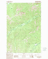
1988 Map of Goose Prairie
USGS Topo · Published 1988About this map
Goose Prairie sits at the heart of this landscape, serving as a focal point for the recreational and natural features within the Snoqualmie National Forest during the late 1980s. The area is defined by the convergence of the American River and the Bumping River, which carve through terrain marked by Norse Peak and the Fifes Peaks. This geography dictates the placement of essential forest infrastructure, from the Hells Crossing Campground to the remote Camp Fife.
Find a feature on this map
39 named features on this map. Tap any name to fly to it.
Don’t see what you’re looking for? This feature index may not catch every label — zoom into the map to look around manually.
Map Details
Editions of this 1988 Goose Prairie Map
This is the sole edition of this map. No revisions or reprints were ever made.
Other maps of this area

1901 · Snoqualmie Pass
USGS Topo · 1:125,000

1902 · Mount Aix
USGS Topo · 1:125,000

1903 · Snoqualmie
USGS Topo · 1:125,000

1904 · Mt Aix
USGS Topo · 1:125,000

1950 · Yakima
USGS Topo · 1:250,000

1957 · Wenatchee
USGS Topo · 1:250,000

1958 · Yakima
USGS Topo · 1:250,000

1961 · Yakima
USGS Topo · 1:250,000

1961 · Easton
USGS Topo · 1:62,500

1962 · Bumping Lake
USGS Topo · 1:62,500