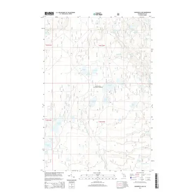
2014 Map of Gooseneck Lake
USGS Topo · Published 2014About this map
Hiawatha National Forest dominates this section of the Upper Peninsula, where a dense network of glacial lakes and wetlands defines the Michigan landscape. The hydrology is centered around the Fishdam River, which draws from several water bodies including Gooseneck Lake and Camp Seven Lake. This 2014 survey documents the intricate drainage patterns of the area, featuring named creeks such as Eighteenmile Cr and Kilpecker Cr, which wind through the forested township lines.
Find a feature on this map
43 named features on this map. Tap any name to fly to it.
Don’t see what you’re looking for? This feature index may not catch every label — zoom into the map to look around manually.
Map Details
Editions of this 2014 Gooseneck Lake Map
This is the sole edition of this map. No revisions or reprints were ever made.
Other maps of this area

1931 · Steuben SW
USGS Topo · 1:31,680

1931 · Cooks NW
USGS Topo · 1:31,680

1931 · Steuben NW
USGS Topo · 1:31,680

1931 · Skeels Lake NE
USGS Topo · 1:31,680

1932 · Garden NW and SW
USGS Topo · 1:31,680

1932 · Skeels Lake SE
USGS Topo · 1:31,680

1932 · Skeels Lake NW and SW
USGS Topo · 1:31,680

1932 · Garden NE
USGS Topo · 1:31,680

1954 · Escanaba
USGS Topo · 1:250,000

1957 · Escanaba
USGS Topo · 1:250,000