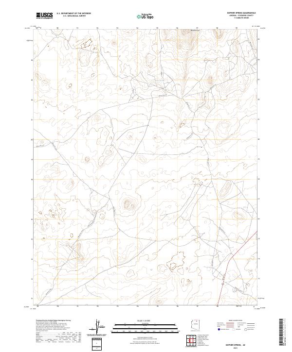
2021 Map of Gopher Spring
USGS Topo · Published 2021About this map
Wildcat Peak stands as the primary topographic landmark in this high-desert region of Coconino County, characterized by a network of managed routes and the vital Gopher Spring. The landscape is defined by its infrastructure of Tribal roads, including the prominent Indian Rte 21 and the winding Navajo Trl, which connect the disparate terrain features and water sources. This 2021 survey illustrates the modern land management within the Navajo Nation, where traditional pathways and contemporary routes like Indian Rte 212 and Indian Rte 6231 traverse the plateaus. The placement of cattle tanks and water points like Gopher Spring indicates the area's continued use for livestock grazing, reflecting the persistent ranching economy of the region. The map reveals the intricate township and range subdivisions, such as t34n r12e and t33.5n r12.5e, which organize this vast landscape.
Find a feature on this map
17 named features on this map. Tap any name to fly to it.
Don’t see what you’re looking for? This feature index may not catch every label — zoom into the map to look around manually.
Map Details
Editions of this 2021 Gopher Spring Map
This is the sole edition of this map. No revisions or reprints were ever made.
Other maps of this area

1883 · Marsh Pass
USGS Topo · 1:250,000

1886 · Echo Cliffs
USGS Topo · 1:250,000

1891 · Echo Cliffs
USGS Topo · 1:250,000

1892 · Marsh Pass
USGS Topo · 1:250,000

1956 · Marble Canyon
USGS Topo · 1:250,000

1959 · Marble Canyon
USGS Topo · 1:250,000

1961 · Marble Canyon
USGS Topo · 1:250,000
1967 · Begashibito Canyon
USGS Topo · 1:24,000
1969 · Tuba City NE
USGS Topo · 1:24,000
1969 · Tuba City
USGS Topo · 1:24,000