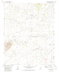
1982 Map of Gopher Spring
USGS Topo · Published 1982About this map
The Navajo Indian Reservation landscape is recorded here in the early 1980s, revealing a high-desert environment defined by sparse human infrastructure and traditional land use. This area of Coconino County is characterized by isolated points of activity like the Rodeo Grounds and Gopher Spring, which serve as vital landmarks in an otherwise open terrain. While the geography is predominantly natural, the presence of several Corral sites and intermittent 4wd routes suggests a continued reliance on livestock and seasonal grazing patterns common to this portion of the reservation. The topographical detail, centered around the prominent Wildcat Peak, provides an essential record of the region's land management and road development just before the modern era of expansion.
Find a feature on this map
7 named features on this map. Tap any name to fly to it.
Don’t see what you’re looking for? This feature index may not catch every label — zoom into the map to look around manually.
Map Details
Editions of this 1982 Gopher Spring Map
This is the sole edition of this map. No revisions or reprints were ever made.
Other maps of this area

1883 · Marsh Pass
USGS Topo · 1:250,000

1886 · Echo Cliffs
USGS Topo · 1:250,000

1891 · Echo Cliffs
USGS Topo · 1:250,000

1892 · Marsh Pass
USGS Topo · 1:250,000

1956 · Marble Canyon
USGS Topo · 1:250,000

1959 · Marble Canyon
USGS Topo · 1:250,000

1961 · Marble Canyon
USGS Topo · 1:250,000
1967 · Begashibito Canyon
USGS Topo · 1:24,000
1969 · Tuba City NE
USGS Topo · 1:24,000
1969 · Tuba City
USGS Topo · 1:24,000