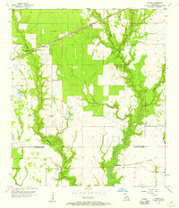
1956 Map of Gordon
USGS Topo · Published 1957About this map
Gordon sits at the junction of the Missouri Pacific railroad and local timber roads in this mid-century survey of the Beauregard Parish and Calcasieu Parish border. The landscape is defined by extensive wetlands and drainage features, notably The Glade and Tiger Glade, which feed into the meandering Beckwith Creek. The presence of the East Perkins Oil and Gas Field in the southwest corner, alongside a Pumping Station, Oil Tank, and Radio Tower, points to the region's mid-twentieth-century industrial expansion.
Find a feature on this map
25 named features on this map. Tap any name to fly to it.
Don’t see what you’re looking for? This feature index may not catch every label — zoom into the map to look around manually.
Map Details
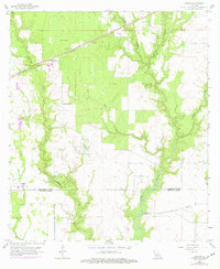
Editions of this 1956 Gordon Map
2 editions found
Other maps of this area

1935 · Buhler
USGS Topo · 1:31,680

1935 · Moss Bluff
USGS Topo · 1:31,680

1935 · Gordon
USGS Topo · 1:31,680

1935 · Gaytine
USGS Topo · 1:31,680

1935 · Longville
USGS Topo · 1:31,680

1947 · Gaytine
USGS Topo · 1:31,680

1947 · Moss Bluff
USGS Topo · 1:31,680

1947 · DeQuincy
USGS Topo · 1:31,680

1947 · Sulphur Mines
USGS Topo · 1:31,680

1947 · Oretta
USGS Topo · 1:31,680