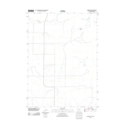
2011 Map of Gordon NW
USGS Topo · Published 2011About this map
Margrave Meadow and the surrounding terrain define this 2011 survey of the Nebraska-South Dakota borderlands. Situated within the Pine Ridge region, the landscape is characterized by a high-plains drainage system that includes Frye Lake in the northeastern corner. The human imprint on this area is sparse and functional, primarily represented by a rectilinear grid of section-line roads such as Nelson Rd. This geometric layout is typical of the Great Plains, where surveying preceded dense settlement, creating a distinct contrast between the rigid north-south road network and the organic, meandering contours of the local drainage basins and low-lying meadowlands. The map captures the quiet character of this border region, emphasizing its topography over urban development.
Find a feature on this map
3 named features on this map. Tap any name to fly to it.
Don’t see what you’re looking for? This feature index may not catch every label — zoom into the map to look around manually.
Map Details
Editions of this 2011 Gordon NW Map
This is the sole edition of this map. No revisions or reprints were ever made.
Other maps of this area

1955 · Hot Springs
USGS Topo · 1:250,000

1955 · Alliance
USGS Topo · 1:250,000

1957 · Alliance
USGS Topo · 1:250,000

1958 · Alliance
USGS Topo · 1:250,000

1967 · Denby
USGS Topo · 1:24,000

1969 · Gordon
USGS Topo · 1:24,000
1969 · Gordon SE
USGS Topo · 1:24,000

1969 · Clinton
USGS Topo · 1:24,000

1969 · Clinton NE
USGS Topo · 1:24,000
1969 · Hog Island
USGS Topo · 1:24,000