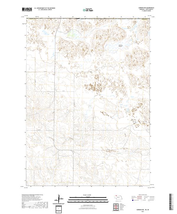
2021 Map of Gordon NW
USGS Topo · Published 2021About this map
Margrave Meadow sits near the northern edge of this high plains landscape in Sheridan Co, Nebraska. This 2021 survey documents the geometric precision of the Public Land Survey System, where sections like t35n r41w and t34n r42w organize the remote ranching country. The terrain is characterized by intricate depression contours and small wetlands, typical of the Nebraska Sandhills, where natural drainage is often subterranean or confined to isolated basins. A sparse but vital road network including 763rd Trl and 730th Rd connects the section corners, following the section lines that have defined Nebraska's rural development for over a century. The absence of traditional settlements highlights the vast, open nature of this cattle country, where topography and water access dictate the placement of ranch infrastructure.
Find a feature on this map
52 named features on this map. Tap any name to fly to it.
Don’t see what you’re looking for? This feature index may not catch every label — zoom into the map to look around manually.
Map Details
Editions of this 2021 Gordon NW Map
This is the sole edition of this map. No revisions or reprints were ever made.
Other maps of this area

1955 · Hot Springs
USGS Topo · 1:250,000

1955 · Alliance
USGS Topo · 1:250,000

1957 · Alliance
USGS Topo · 1:250,000

1958 · Alliance
USGS Topo · 1:250,000

1967 · Denby
USGS Topo · 1:24,000

1969 · Gordon
USGS Topo · 1:24,000
1969 · Gordon SE
USGS Topo · 1:24,000

1969 · Clinton
USGS Topo · 1:24,000

1969 · Clinton NE
USGS Topo · 1:24,000
1969 · Hog Island
USGS Topo · 1:24,000