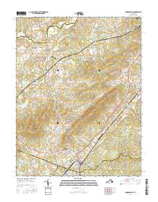
2016 Map of Gordonsville
USGS Topo · Published 2016About this map
Gordonsville anchors the southeastern corner of this Central Virginia landscape, where the historic road network converges at the meeting point of Orange, Albemarle, and Louisa counties. The terrain is defined by a series of prominent rises including Cowherd Mtn, Cameron Mtn, and Scott Mtn, which overlook a valley floor crossed by the Norfolk Southern railroad. Near Montpelier Station, the James Madison Cem marks the enduring heritage of the region, while smaller settlements like Liberty Mills and Old Somerset illustrate the legacy of early river-and-road commerce. The Rapidan River flows across the northern reach, forming the boundary with Madison County. Aviation history is present through both the Gordonsville Municipal Airport and the smaller Hen & Bacon Airport, reflecting the area's continued role as a regional transit hub.
Find a feature on this map
142 named features on this map. Tap any name to fly to it.
Don’t see what you’re looking for? This feature index may not catch every label — zoom into the map to look around manually.
Map Details
Editions of this 2016 Gordonsville Map
This is the sole edition of this map. No revisions or reprints were ever made.
Other maps of this area

1892 · Gordonsville
USGS Topo · 1:125,000

1930 · Madison
USGS Topo · 1:48,000

1933 · Madison
USGS Topo · 1:62,500

1935 · Charlottesville
USGS Topo · 1:62,500

1939 · Charlottesville
USGS Topo · 1:62,500

1949 · Charlottesville
USGS Topo · 1:250,000

1949 · Charlottesville
USGS Topo · 1:62,500

1956 · Charlottesville
USGS Topo · 1:250,000

1961 · Gordonsville
USGS Topo · 1:62,500

1961 · Rapidan
USGS Topo · 1:62,500