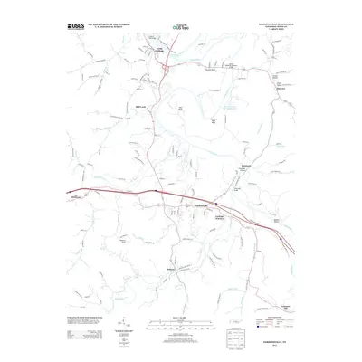
2013 Map of Gordonsville
USGS Topo · Published 2013About this map
The Cumberland River and Caney Fork converge in this section of Middle Tennessee, shaping a landscape of deep river bends and industrial landmarks. Industrial activity is prominent at the Jersey Miniery Zinc Company Lake north of Gordonsville, reflecting the region's mineral heritage. Modern infrastructure spans the waterways via the Cordell Hull Bridge at South Carthage and the Benton McMillian Memorial Bridge further east. Small settlements such as Hickman and Elmwood anchor the rural landscape, connected by a network of hollows like Trousdale Hollow and high points such as Winfree Knob. The transition from river-bottom commerce to the ridges of the Highland Rim is evident in the layout of historic crossings like the Stonewall Bridge and the rail-aligned community of Carthage Junction.
Find a feature on this map
144 named features on this map. Tap any name to fly to it.
Don’t see what you’re looking for? This feature index may not catch every label — zoom into the map to look around manually.
Map Details
Editions of this 2013 Gordonsville Map
This is the sole edition of this map. No revisions or reprints were ever made.
Other maps of this area

1928 · Gordonsville
USGS Topo · 1:62,500

1932 · Carthage
USGS Topo · 1:62,500

1942 · Statesville
USGS Topo · 1:100,000

1956 · Corbin
USGS Topo · 1:250,000

1956 · Nashville
USGS Topo · 1:250,000

1958 · New Middleton
USGS Topo · 1:24,000

1958 · Corbin
USGS Topo · 1:250,000

1958 · Dixon Springs
USGS Topo · 1:24,000
1958 · Alexandria
USGS Topo · 1:24,000

1959 · Nashville
USGS Topo · 1:250,000