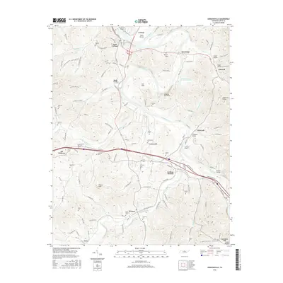
2016 Map of Gordonsville
USGS Topo · Published 2016About this map
Carthage and its southern neighbors sit at a significant river confluence where the Cumberland River meets the Caney Fork. This 2016 survey illustrates the intricate relationship between the river's winding bends, such as Boulton Bend and Hell Bend, and the established transportation routes that cross them via the Cordell Hull Bridge and Benton McMillian Memorial Bridge. The landscape is characterized by prominent high points like Winfree Knob and Cowan Hill, interspersed with narrow hollows such as Timberlake Hollow and Condit Hollow.
Find a feature on this map
135 named features on this map. Tap any name to fly to it.
Don’t see what you’re looking for? This feature index may not catch every label — zoom into the map to look around manually.
Map Details
Editions of this 2016 Gordonsville Map
This is the sole edition of this map. No revisions or reprints were ever made.
Other maps of this area

1928 · Gordonsville
USGS Topo · 1:62,500

1932 · Carthage
USGS Topo · 1:62,500

1942 · Statesville
USGS Topo · 1:100,000

1956 · Corbin
USGS Topo · 1:250,000

1956 · Nashville
USGS Topo · 1:250,000

1958 · New Middleton
USGS Topo · 1:24,000

1958 · Corbin
USGS Topo · 1:250,000

1958 · Dixon Springs
USGS Topo · 1:24,000
1958 · Alexandria
USGS Topo · 1:24,000

1959 · Nashville
USGS Topo · 1:250,000