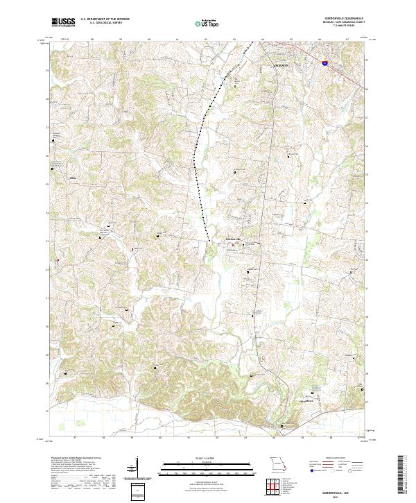
2021 Map of Gordonville
USGS Topo · Published 2021About this map
Gordonville and the surrounding rural landscapes of Cape Girardeau County are defined by a network of small family and church burial grounds that trace the heritage of early German and Lutheran settlement. From Dutchtown in the south to the outskirts of Jackson in the north, the land is carved by the meandering courses of Hubble Cr and Williams Cr. The map reveals a dense concentration of local history markers, including the Old Bethel Cem, the German Evangelical Church Cem, and the Zion Lutheran Church Cem. These features, alongside small communities like Tilsit, suggest a long-standing agricultural and religious infrastructure. The terrain is characterized by numerous small branches and creeks such as Heiterman Cr and Foster Cr that drain the undulating countryside, while modern road names like Dogwood Ave and S Farmington Rd highlight the area's continued residential integration.
Find a feature on this map
132 named features on this map. Tap any name to fly to it.
Don’t see what you’re looking for? This feature index may not catch every label — zoom into the map to look around manually.
Map Details
Editions of this 2021 Gordonville Map
This is the sole edition of this map. No revisions or reprints were ever made.
Other maps of this area

1922 · Cape Girardeau
USGS Topo · 1:62,500

1924 · Cape Girardeau
USGS Topo · 1:62,500

1933 · Marble Hill
USGS Topo · 1:62,500

1934 · Morley
USGS Topo · 1:62,500

1934 · Advance
USGS Topo · 1:62,500

1937 · Marble Hill
USGS Topo · 1:62,500

1939 · Morley
USGS Topo · 1:62,500

1939 · Advance
USGS Topo · 1:62,500

1949 · Paducah
USGS Topo · 1:250,000

1950 · Paducah
USGS Topo · 1:250,000