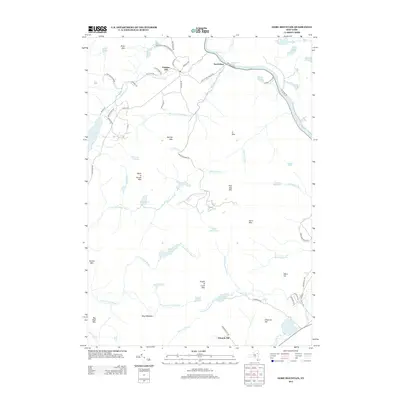
2013 Map of Gore Mountain
USGS Topo · Published 2013About this map
The Hudson River flows through the northeastern corner of this landscape, carving a path past the settlement of North River and the rapids at Perry Ehlers Rapids. This territory, situated within the Adirondack Park Preserve, is defined by a dense concentration of named peaks and high-elevation water bodies. The terrain rises sharply to summits like Gore Mtn, Harvey Mtn, and Height of Land Mtn. Many small drainages, including Balm of Gilead Brook and Chatiemac Brook, feed into larger basins such as Thirteenth Lake. The presence of Barton Mines Rd suggests the local importance of industrial access in this mountainous region, while smaller communities like Christian Hill are connected by a network of rural routes such as Cemetery Rd and Old School House Rd.
Find a feature on this map
76 named features on this map. Tap any name to fly to it.
Don’t see what you’re looking for? This feature index may not catch every label — zoom into the map to look around manually.
Map Details
Editions of this 2013 Gore Mountain Map
This is the sole edition of this map. No revisions or reprints were ever made.
Other maps of this area

1895 · North Creek
USGS Topo · 1:62,500

1897 · North Creek
USGS Topo · 1:62,500

1897 · Schroon Lake
USGS Topo · 1:62,500

1898 · Newcomb
USGS Topo · 1:62,500

1898 · Thirteenth Lake
USGS Topo · 1:62,500

1901 · Newcomb
USGS Topo · 1:62,500

1950 · Glens Falls
USGS Topo · 1:250,000

1950 · Utica
USGS Topo · 1:250,000

1953 · Schroon Lake
USGS Topo · 1:62,500

1954 · Newcomb
USGS Topo · 1:62,500