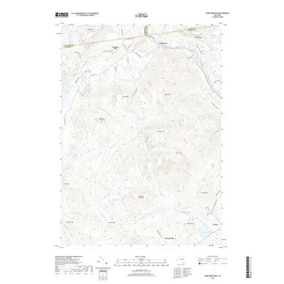
2019 Map of Gore Mountain
USGS Topo · Published 2019About this map
The high peaks of the Adirondack Park Preserve dominate this terrain, centered on the prominent massif of Gore Mtn. To the north, the Hudson River cuts through the landscape near the settlement of North River, where local history is etched into the road network by names like School House Rd and Cemetery Rd. The map illustrates a high-altitude wilderness defined by complex drainage basins, including the headwaters of Thirteenth Brook and Chatiemac Brook, which flow from hidden water bodies like Thirteenth Lake and Botheration Pond. Settlement is sparse and concentrated along the valleys, with the community of Sodom appearing in the southeast. The inclusion of Barton Mines Rd points to the area's industrial past, while the Ski Bowl Connector reflects more modern recreational uses of these mountains.
Find a feature on this map
81 named features on this map. Tap any name to fly to it.
Don’t see what you’re looking for? This feature index may not catch every label — zoom into the map to look around manually.
Map Details
Editions of this 2019 Gore Mountain Map
This is the sole edition of this map. No revisions or reprints were ever made.
Other maps of this area

1895 · North Creek
USGS Topo · 1:62,500

1897 · North Creek
USGS Topo · 1:62,500

1897 · Schroon Lake
USGS Topo · 1:62,500

1898 · Newcomb
USGS Topo · 1:62,500

1898 · Thirteenth Lake
USGS Topo · 1:62,500

1901 · Newcomb
USGS Topo · 1:62,500

1950 · Glens Falls
USGS Topo · 1:250,000

1950 · Utica
USGS Topo · 1:250,000

1953 · Schroon Lake
USGS Topo · 1:62,500

1954 · Newcomb
USGS Topo · 1:62,500