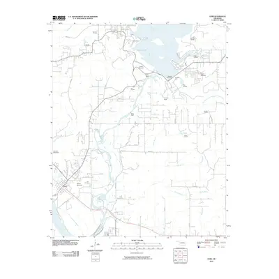
2010 Map of Gore
USGS Topo · Published 2010About this map
The town of Gore sits at the confluence of the Illinois River and the Arkansas River, serving as a gateway to the major water engineering projects of the twentieth century. Dominating the northern landscape is Tenkiller Lake, held back by the massive Tenkiller Ferry Dam and Tenkiller Dam. This terrain is characterized by dramatic bluffs and family-named ridges, including Beetle Bluff, Runyan Bluff, and Merford Ridge. Genealogists will find a high density of small family and community burial grounds across the quadrangle, such as the Tee Hee Cemetery, Stevenson Cemetery, and Red Bird Cemetery. The map captures a transition between the river lowlands and the higher elevations of Sausbee Mountain and Linder Mountain, illustrating the development of the region's recreational and utility infrastructure alongside older rural settlements.
Find a feature on this map
58 named features on this map. Tap any name to fly to it.
Don’t see what you’re looking for? This feature index may not catch every label — zoom into the map to look around manually.
Map Details
Editions of this 2010 Gore Map
This is the sole edition of this map. No revisions or reprints were ever made.
Other maps of this area

1898 · Tahlequah
USGS Topo · 1:125,000

1900 · Sansbois
USGS Topo · 1:125,000

1900 · Sallisaw
USGS Topo · 1:125,000

1901 · Muscogee
USGS Topo · 1:125,000

1901 · Tahlequah
USGS Topo · 1:125,000

1905 · Muscogee
USGS Topo · 1:125,000

1905 · Tahlequah
USGS Topo · 1:125,000

1909 · Sans Bois
USGS Topo · 1:125,000

1911 · Sallisaw
USGS Topo · 1:125,000

1911 · Sansbois
USGS Topo · 1:125,000