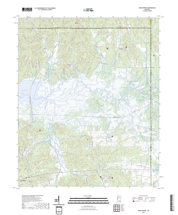
2024 Map of Gore Springs
USGS Topo · Published 2024About this map
The Yalobusha River winds through this landscape on its way toward Grenada Lake, carving a broad basin that marks the boundary between Grenada, Yalobusha, and Calhoun counties. The topography is defined by the transition from river bottomlands to higher ground, notably along Dividing Ridge Rd, which follows the natural crest separating local drainage systems. This 2024 map documents the rural settlement patterns around Gore Springs and the smaller community of Youngs, showing a network of county roads like Old Hwy 8 that connect isolated homesteads and family cemeteries.
Find a feature on this map
73 named features on this map. Tap any name to fly to it.
Don’t see what you’re looking for? This feature index may not catch every label — zoom into the map to look around manually.
Map Details
Editions of this 2024 Gore Springs Map
This is the sole edition of this map. No revisions or reprints were ever made.
Other maps of this area

1953 · Walthall
USGS Topo · 1:62,500

1953 · West Point
USGS Topo · 1:250,000

1954 · Pittsboro
USGS Topo · 1:62,500

1954 · Duck Hill
USGS Topo · 1:62,500

1955 · Coffeeville
USGS Topo · 1:62,500

1958 · West Point
USGS Topo · 1:250,000

1963 · West Point
USGS Topo · 1:250,000
1971 · Coffeeville
USGS Topo · 1:24,000
1983 · Duck Hill
USGS Topo · 1:24,000
1983 · Cadaretta
USGS Topo · 1:24,000