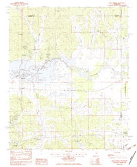
1983 Map of Gore Springs
USGS Topo · Published 1984About this map
Grenada Lake dominates the central landscape of this survey, where the Yalobusha River enters the reservoir. The map documents a period of transition for the eastern end of the lake, showing the fluctuating water levels between the Summer Pool and Winter Pool. On the northern shores, the settlement of Youngs and the nearby Youngs Landing represent long-standing riverfront connections, while the communities of Graysport and Gore Springs anchor the southern and western portions of the quadrangle.
Find a feature on this map
31 named features on this map. Tap any name to fly to it.
Don’t see what you’re looking for? This feature index may not catch every label — zoom into the map to look around manually.
Map Details
Editions of this 1983 Gore Springs Map
This is the sole edition of this map. No revisions or reprints were ever made.
Other maps of this area

1953 · Walthall
USGS Topo · 1:62,500

1953 · West Point
USGS Topo · 1:250,000

1954 · Pittsboro
USGS Topo · 1:62,500

1954 · Duck Hill
USGS Topo · 1:62,500

1955 · Coffeeville
USGS Topo · 1:62,500

1958 · West Point
USGS Topo · 1:250,000

1963 · West Point
USGS Topo · 1:250,000
1971 · Coffeeville
USGS Topo · 1:24,000
1983 · Duck Hill
USGS Topo · 1:24,000
1983 · Cadaretta
USGS Topo · 1:24,000