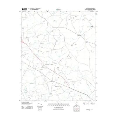
2011 Map of Goretown
USGS Topo · Published 2011About this map
Goretown and Loris anchor this part of Horry County, where the landscape is defined by the winding paths of Buck Creek and Juniper Swamp. This 2011 survey reveals a territory marked by numerous small, family-named burial grounds and rural intersections like Grahams Crossroads and Sandy Plain. The drainage patterns of Toms Fork and Ironhill Branch suggest a low-lying geography that has historically dictated road placement and settlement clusters. Genealogists will find a dense concentration of local history in the many listed cemeteries, including Hardee, Soles, and Milligan. Transportation in the area relies on a network of highways such as HWY-66 and HWY-915, connecting local communities to the Twin City Airport. The presence of Hughes Mill Pond reflects the early water-power economy that once shaped the growth of these South Carolina rural districts.
Find a feature on this map
133 named features on this map. Tap any name to fly to it.
Don’t see what you’re looking for? This feature index may not catch every label — zoom into the map to look around manually.
Map Details
Editions of this 2011 Goretown Map
This is the sole edition of this map. No revisions or reprints were ever made.
Other maps of this area

1937 · Nixonville
USGS Topo · 1:48,000

1942 · Nixonville
USGS Topo · 1:62,500

1943 · Pireway
USGS Topo · 1:31,680

1943 · Nakina
USGS Topo · 1:24,000

1944 · Longs
USGS Topo · 1:31,680

1949 · Georgetown
USGS Topo · 1:250,000

1953 · Longs
USGS Topo · 1:24,000
1953 · Pireway
USGS Topo · 1:24,000

1953 · Florence
USGS Topo · 1:250,000

1954 · Florence
USGS Topo · 1:250,000